The TWG held its fifth virtual meeting on Wednesday, 24 February 2021, 14:00 PM – 16:00 hours, Bangkok time
Meeting Highlight 1: Estimating Population Exposed to Flood Risk using Remote Sensing and GIS
Presenter: Aahlaad Musunuru , GIS Consultant, ESCAP
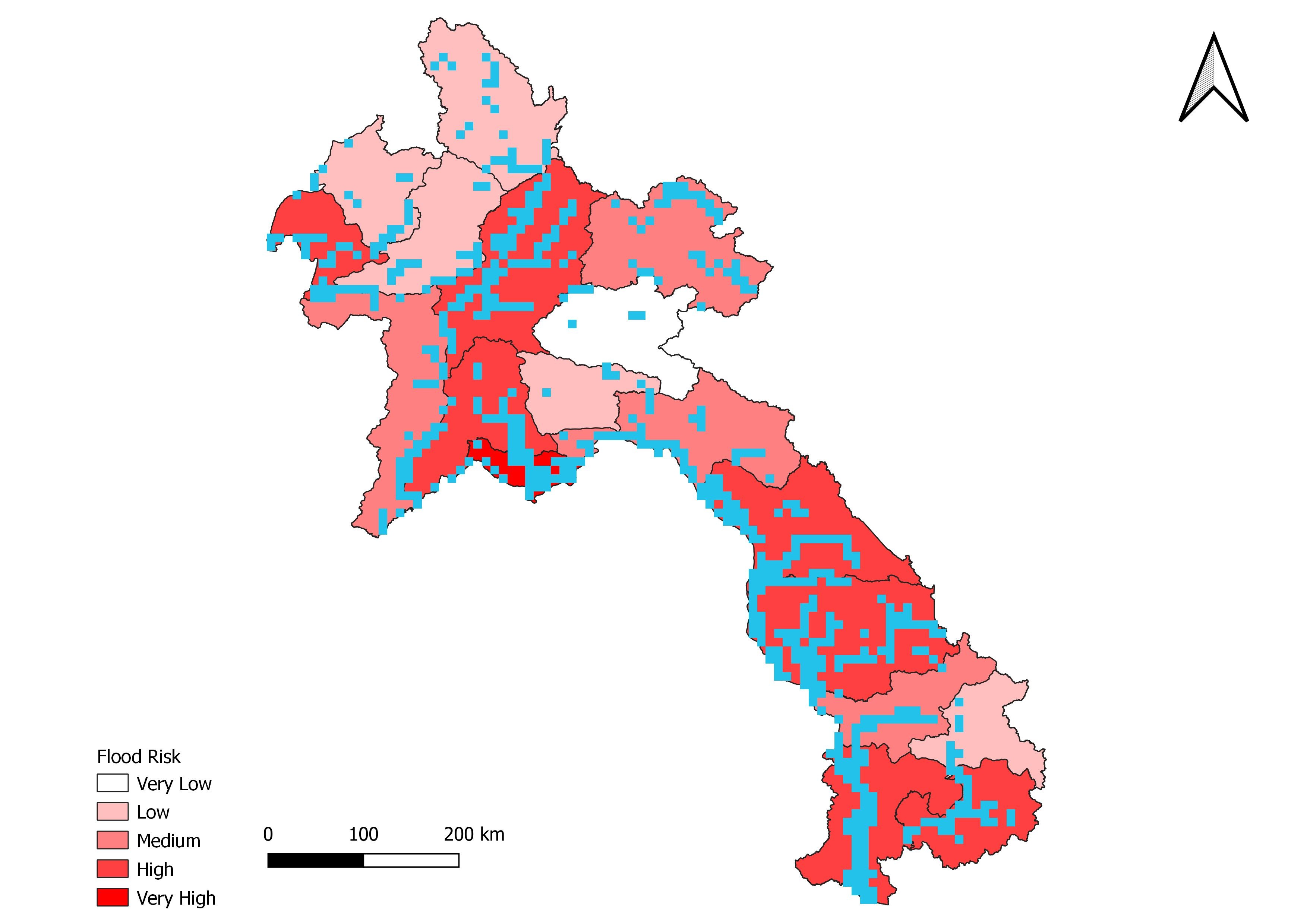
The presentation will show the methodology for calculating high resolution gridded-population and urban (built-up area) maps and statistics in GIS for overlay with the available maps of hazards (e.g. potential flood inundation maps) utilizing a real-life example and real data from Lao People's Democratic Republic to estimate population exposure to hazards – one of the core components of disaster risk measurement. The methodology is implemented using Remote Sensing and GIS tools.
The Global Human Settlement (GHSL) data sets https://ghsl.jrc.ec.europa.eu/download.php?ds=buS2. was used to distribute the present census data to Lao People's Democratic Republic. Population exposed to Flood in each providence is analyzed by considering 3 components: 1 = Flood Inundation Area; 2= Population Affected and 3 = Capacity of the population (SHDI) = Sub national Human Development Index.
Risk is estimates as Flood inundation area* Population Affected * Capacity of People
From this Tool, courtiers can generate their one risk statical information the number of population and infrastructure affected to flood inundation and the total flood affected areas in each province and also, they can generate their one high resolution population raster for their country moreover, the flood inundation fallowed by risk maps and statistical information can be shared using ArcGIS story maps application.
Meeting Highlight 2: The GLobal IDEntifier (GLIDE) number, Asian Disaster Reduction Center (ADRC)
Presenter: Shiomi Yumi , Senior Researcher, ADRC, Japan

The Asian Disaster Reduction Center (ADRC) has developed a database of disaster information to serve as a clearinghouse of disaster information from various sources since 1998. The database provides a brief summary of disasters (dates, locations, and descriptions), outlines of damage status, and links to information from ADRC member countries, and graphic information.
GLIDE Number:
Since 2001, ADRC has conducted a globally common, unique identification scheme for disaster events as a tool which provides a unique number to each disaster facilitating the sharing of disaster information archived by organizations around the world. The project is known as the GLobal unique disaster IDEntifier Number (GLIDE). GLIDE is an open standard, accessible at no cost to anyone interested in disaster data. Using GLIDE will promote transparent linking and efficient retrieval of disaster information from multiple sources, thereby facilitating improved disaster data management and analysis.
Meeting Highlight 3: Cambodia’s Disaster Loss and Damage Information System (known as ‘CAMDI’)
Presenter: Sok Kosal , Deputy Director General, National Institute of Statistics (NIS), Cambodia
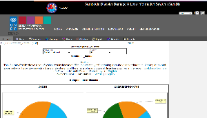
Cambodia Disaster Loss and Damage Information System (known as ‘CAMDI’), is a database first developed in 2015 under the National Committee for Disaster Management with support of the United Nations Development Programme (UNDP), as part of its commitment to strengthen capacities for disaster statistics in the country. Records of disaster events from 1996 onwards were inputted into the database, allowing a view of disasters across 20 years for a better analysis of trends in disaster loss and impacts. Historical data is disaggregated by hazard, sex, age, disability, income, and geography to ensure that vulnerable groups can be easily identified and targeted.
The CAMDI will be aligned with Cambodia’s Disaster Risk Reduction Framework (2019-2030), and the National Action Plan for Disaster Risk Reduction (2019-2025) and is consistent with the Sendai framework. This will ensure that disaster management authorities at the country-level are equipped with readiness to record local level disasters and use the data for Sendai reporting and monitoring.